
Changing your mode of transportation on Google Maps is a breeze, and this article from worldtransport.net will guide you through the simple steps. Whether you’re switching from walking to driving or exploring other options like public transit or cycling, understanding how to navigate Google Maps effectively can significantly enhance your travel experience. Discover seamless navigation and optimize your routes for efficient transportation.
1. Changing Transportation Mode on Google Maps on iPhone
Do you want to switch from walking to driving on Google Maps using your iPhone? Yes, it is possible. Follow these easy steps:
-
Open Google Maps: Launch the Google Maps application on your iPhone.
-
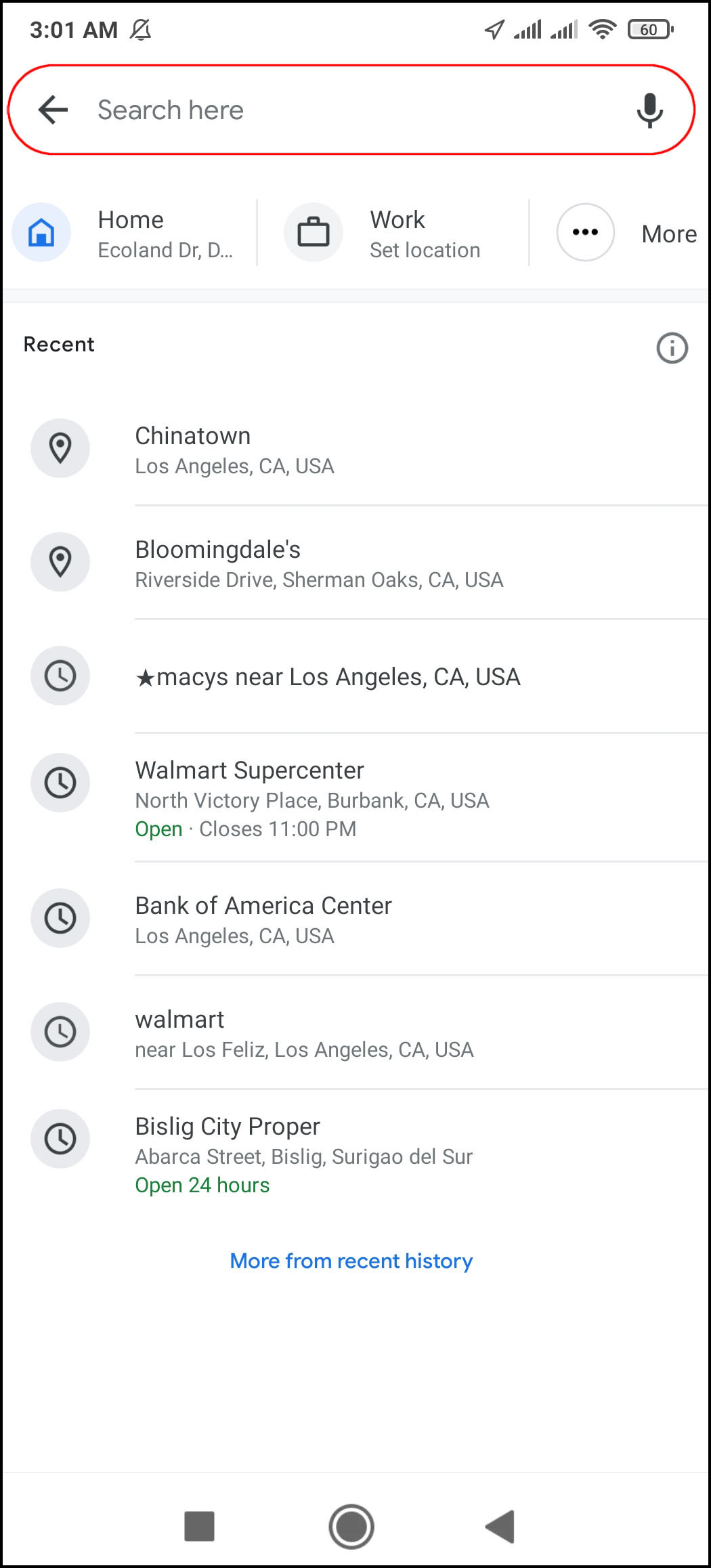
Enter Destination: Tap the “Search here” field at the top and type in where you want to go.
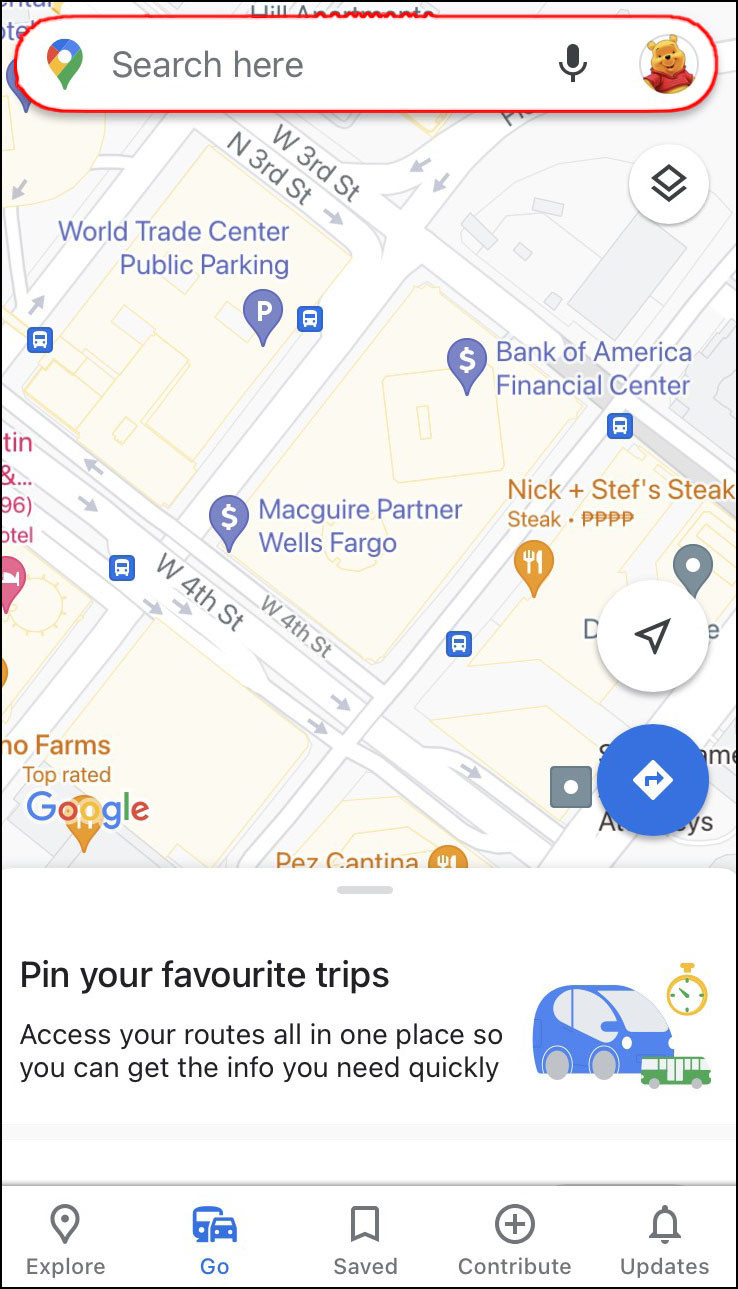 Typing a destination into the Google Maps search bar on an iPhone
 -
Find Directions: Tap the “Directions” option located under the map.
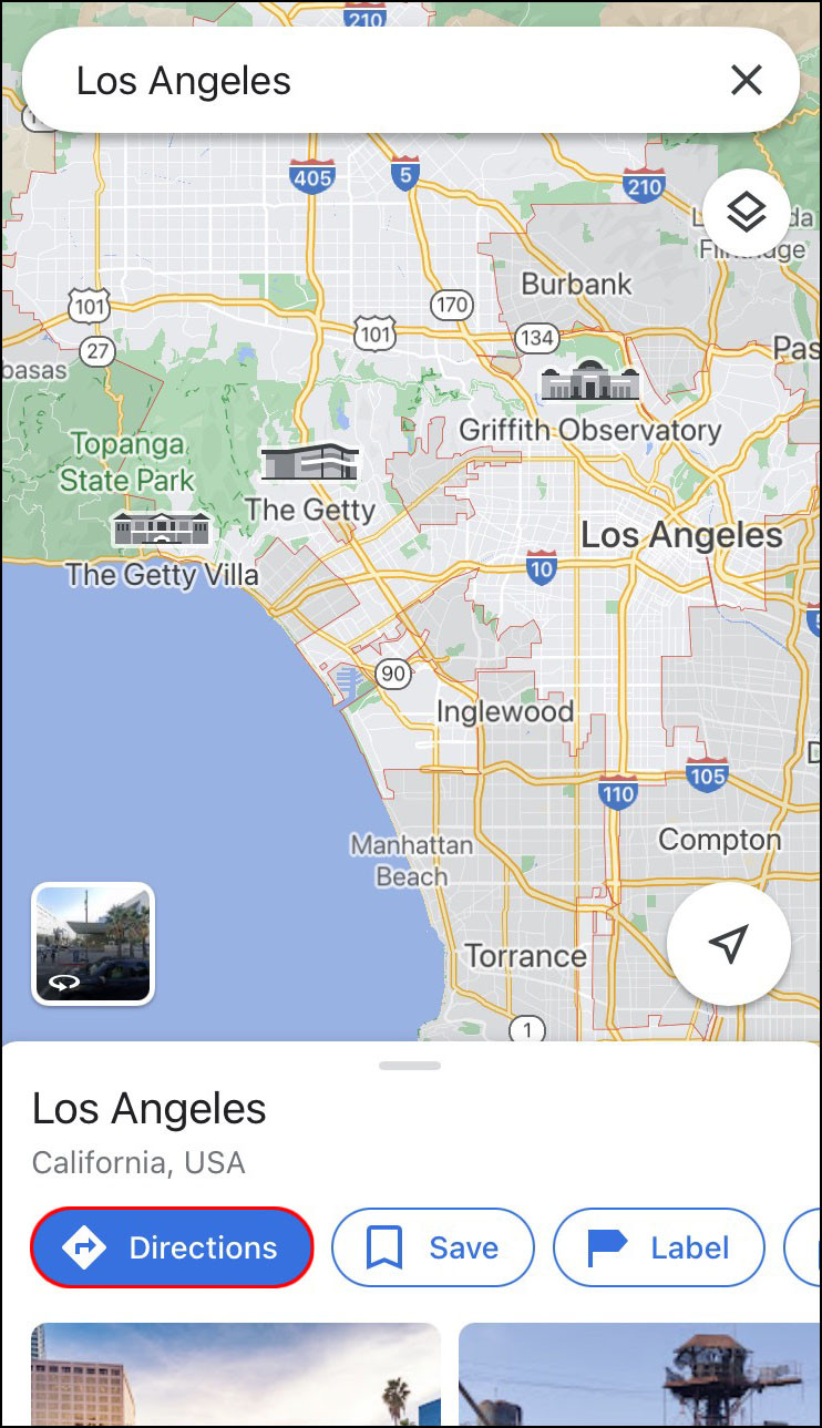 Tapping the Directions option under the map in Google Maps on an iPhone
 -
Set Starting Point: Select your starting location by either tapping “Your Location” for your current spot or typing a different address in the provided field.
 Choosing a starting location in Google Maps on an iPhone
 -
Select Driving Mode: Tap the “Car” icon at the top to switch to driving mode. Grant Google Maps access to your location and audio if prompted.
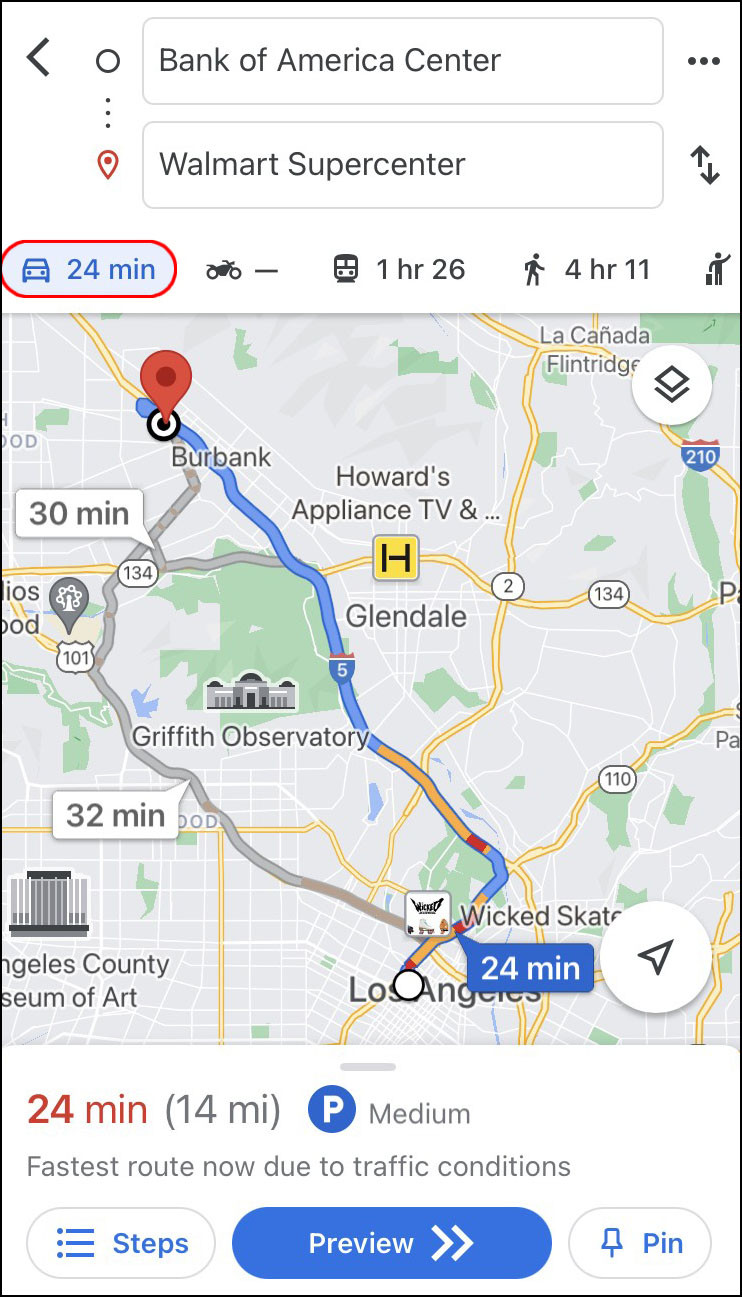 Selecting the Car icon to switch to driving mode in Google Maps on an iPhone
 -
View Route Options: Google Maps will display the fastest route in blue, with alternative routes shown in gray. The estimated travel time will be visible next to the “Car” icon.
-
Start Navigation: Tap the “Start” button at the bottom to begin your journey with voice guidance.
 Tapping the Start button to begin navigation in Google Maps on an iPhone
 -
Pin Route (Optional): If you’re not ready to start immediately, tap the “Pin” button to save the route for later.
Enhancing Your iPhone Navigation Experience
Google Maps offers customizable voice guidance. Tap the headphone icon to choose between “On,” “Alerts only,” or muted modes. You can also change the voice language in the app’s settings. According to usability studies from the Human Factors and Ergonomics Society, voice guidance significantly reduces driver distraction. When you’re done, tap the “Exit” button to leave the directions mode.
2. How to Change Mode of Transport On Google Maps on Android
Do you need to switch from walking to driving mode on Google Maps with your Android device? Absolutely! Here’s how you can do it:
-
Open Google Maps: Launch the Google Maps app on your Android device.
-
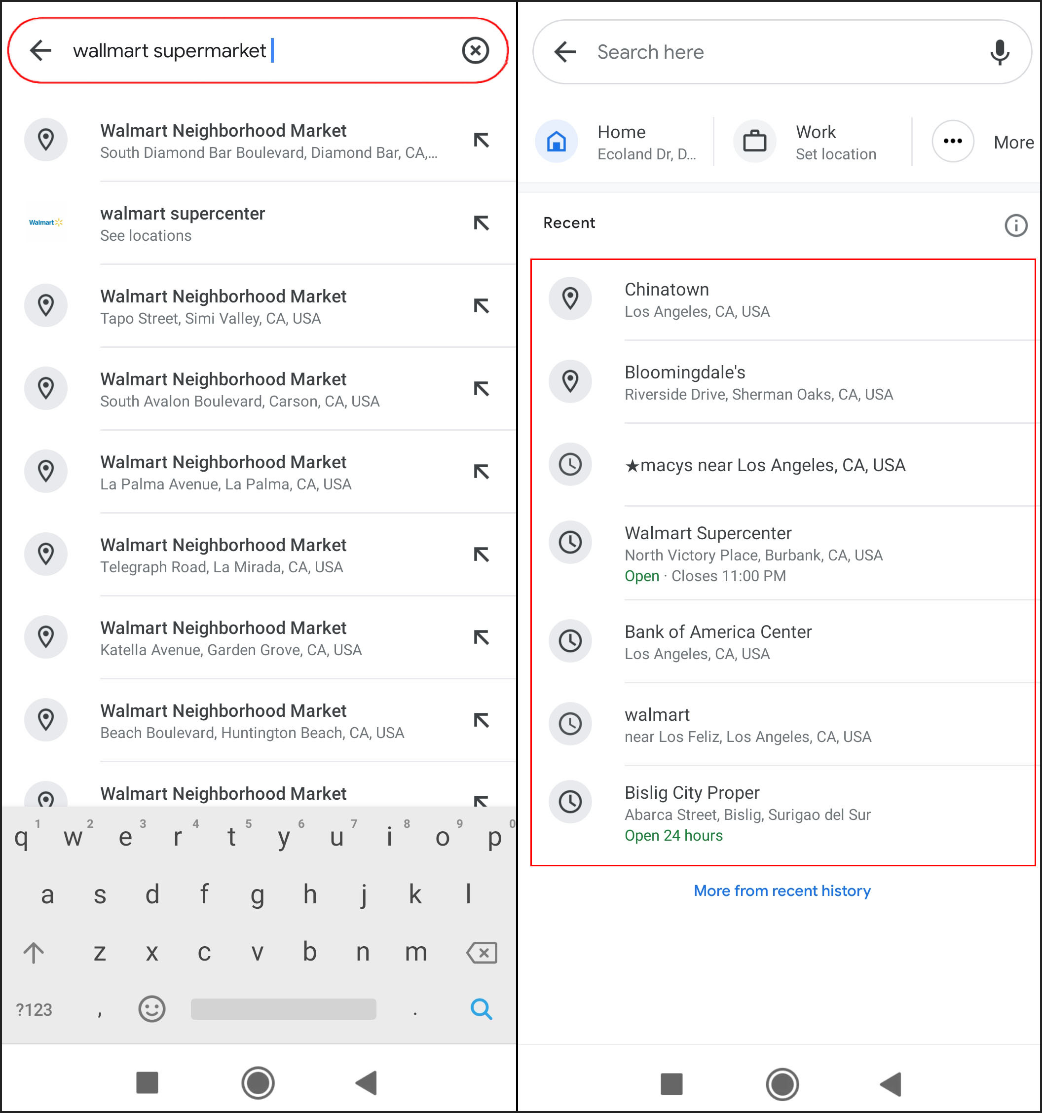
Enter Destination: Tap the “Search here” field and type in your destination.
 Entering a destination in Google Maps on an Android device
 -
Find Directions: Tap the “Directions” button under the location name.
 Tapping the Directions button in Google Maps on an Android device
 -
Set Starting Point: Choose your starting location by tapping “Choose location” or selecting from recommended locations.
-
Select Driving Mode: Tap the “Car” icon at the top of the screen.
-
Start Navigation: Tap the “Start” button to begin your drive. Google Maps will show your current location and guide you to your destination.
Tips for Android Users
You can easily change your route by tapping and dragging a location on the route to a different spot. Remember, Google Maps needs your phone’s GPS turned on to function properly. According to a study by the U.S. Department of Transportation, using GPS navigation reduces travel time by an average of 18%.
3. Changing Transportation Mode on Google Maps on Desktop
Do you prefer using Google Maps on your computer for a clearer view? You can switch from walking to driving mode on a desktop PC as well. Here’s how:
-
Open Google Maps: Open your browser and go to the Google Maps website.
-
Enter Destination: Type your destination in the “Search Google Maps” field in the upper-left corner.
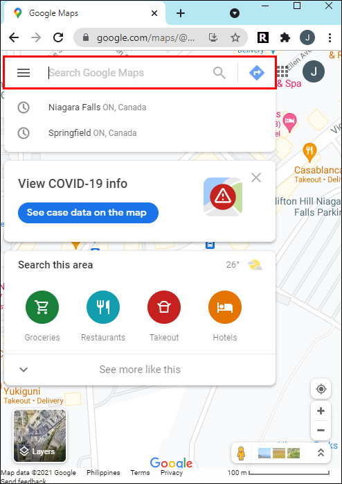 Typing a destination in Google Maps on a desktop PC
 -
Find Directions: Click the “Directions” button on the left sidebar.
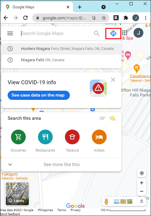 Clicking the Directions button on Google Maps on a desktop PC
 -
Set Starting Point: Choose your starting location. Google Maps will display the fastest route.
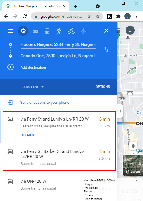 Setting the starting point in Google Maps on a desktop PC
 -
Select Driving Mode: Find the “Car” icon in the upper-left corner and click on it.
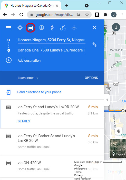 Selecting the Car icon to switch to driving mode in Google Maps on a desktop PC
 -
Send Directions to Your Phone: Click “Send directions to your phone” to follow them while driving. You can send via email, phone number, or print.
-
Start Navigation on Your Phone: Open the directions on your phone, tap the “Start” button, and begin driving.
Optimizing Your Desktop Experience
Google Maps shows recommended routes in blue (best) and gray (alternatives). Each route displays the estimated time and distance. If you choose a different route, Google Maps automatically adjusts the directions. According to the Bureau of Transportation Statistics, planning your route in advance can reduce unexpected delays by up to 25%.
4. Understanding the User Search Intent
What are the primary intentions behind users searching for “How Do You Change Mode Of Transport On Google Maps”? Here are five key search intents:
- Step-by-Step Instructions: Users want clear, easy-to-follow guides on how to switch between different transportation modes (walking, driving, public transit, cycling) on Google Maps across various devices (iPhone, Android, desktop).
- Troubleshooting: Users may be experiencing difficulties in changing modes and need solutions to common issues, such as the mode option not appearing or the app not recognizing their location.
- Feature Awareness: Users want to explore all available transportation modes and understand the benefits of each, such as real-time traffic updates for driving or route optimization for cycling.
- Customization: Users are looking for ways to customize their navigation experience based on their preferred mode of transport, including setting default modes or adjusting preferences for specific types of routes.
- Efficiency: Users aim to find the quickest and most efficient way to change modes, especially when they need to switch mid-journey due to unexpected circumstances like traffic or weather conditions.
5. Exploring Google Maps Features
What else can Google Maps do to enhance your travel experience? Google Maps is packed with features to make your journey smoother and more efficient.
| Feature | Description | Benefit |
|---|---|---|
| Real-Time Traffic Updates | Provides live traffic conditions, including accidents, road closures, and congestion levels. | Helps you avoid delays and find faster routes. |
| Public Transit Options | Offers detailed information on bus, train, and subway routes, including schedules and real-time arrival/departure times. | Simplifies navigating public transportation systems. |
| Cycling Routes | Suggests bike-friendly routes with considerations for bike lanes, elevation changes, and traffic conditions. | Ensures a safer and more enjoyable cycling experience. |
| Walking Directions | Provides step-by-step walking directions with considerations for pedestrian paths and crosswalks. | Makes walking navigation easier and more reliable. |
| Offline Maps | Allows you to download maps for offline use, ensuring navigation even without an internet connection. | Useful for areas with poor connectivity or when you want to save data. |
| Voice Guidance | Offers turn-by-turn voice instructions, allowing you to keep your eyes on the road. | Enhances safety and convenience while driving, cycling, or walking. |
| Lane Guidance | Indicates the correct lane to be in for upcoming turns and exits. | Prevents last-minute lane changes and reduces stress on highways. |
| Alternate Routes | Suggests multiple route options, allowing you to choose the best one based on your preferences. | Provides flexibility and control over your journey. |
| Sharing Location | Enables you to share your real-time location with friends and family. | Useful for coordinating meetups and ensuring safety. |
| Street View | Offers a 360-degree view of streets and landmarks. | Helps you visualize your destination and surroundings before you arrive. |
6. Optimizing Your Route on Google Maps
How can you make the most of Google Maps to optimize your routes? Optimizing your route on Google Maps involves leveraging its features to find the quickest, most efficient, and most convenient path to your destination. According to a study by INRIX, a leading transportation analytics firm, optimizing routes can save drivers an average of 20% on their commute time.
Steps to Optimize Your Route
- Use Real-Time Traffic Data: Enable traffic updates to avoid congested areas. Google Maps uses real-time data to suggest alternative routes that bypass traffic jams.
- Consider Public Transit Options: If you’re in a city, check public transit routes for a potentially faster and more cost-effective alternative to driving.
- Explore Cycling Routes: For shorter distances, cycling can be a healthy and efficient option. Google Maps provides bike-friendly routes that consider bike lanes and elevation.
- Download Offline Maps: If you’re traveling to an area with unreliable internet, download offline maps to ensure you can still navigate without a connection.
- Adjust Route Preferences: Customize your route preferences to avoid tolls, highways, or ferries, depending on your priorities.
- Add Multiple Stops: If you need to make several stops along the way, add them to your route to optimize the order and minimize backtracking.
Additional Tips
- Check for Peak Hours: Be aware of peak traffic hours in your area and adjust your travel time accordingly.
- Utilize Street View: Use Street View to familiarize yourself with your destination and identify parking options.
- Monitor Voice Guidance: Pay attention to voice guidance for real-time updates and turn-by-turn directions.
7. Navigating Public Transportation
How effective is Google Maps for navigating public transport? Navigating public transportation with Google Maps can be incredibly efficient, especially in urban areas. The app provides detailed information on various transit options, including buses, trains, subways, and trams.
Key Features for Public Transit
- Real-Time Schedules: Access up-to-date schedules for all transit lines, ensuring you know exactly when the next bus or train is arriving.
- Route Planning: Enter your destination, and Google Maps will suggest the best public transit routes, including transfers and walking directions to and from stations.
- Service Alerts: Receive notifications about delays, cancellations, and service disruptions, allowing you to adjust your plans accordingly.
- Accessibility Information: Find information about accessible stations and routes, catering to individuals with disabilities.
- Integration with Ride-Sharing: Seamlessly integrate ride-sharing options like Uber and Lyft for the first or last leg of your journey.
Tips for Efficient Public Transit Navigation
- Set Departure/Arrival Time: Specify your desired departure or arrival time to see the most relevant transit options.
- Save Favorite Routes: Save your frequently used routes for quick access.
- Use Offline Maps: Download offline maps for areas with limited connectivity.
- Check for Peak Hours: Be aware of peak travel times and plan accordingly to avoid crowded buses and trains.
8. Exploring Cycling and Walking Navigation
Can Google Maps help you with cycling and walking directions? Yes, Google Maps offers specialized navigation for both cycling and walking, making it easier to explore your surroundings on foot or by bike.
Cycling Navigation
- Bike-Friendly Routes: Google Maps suggests routes that prioritize bike lanes, paths, and quieter streets, minimizing exposure to heavy traffic.
- Elevation Data: The app provides elevation profiles, allowing you to anticipate and prepare for hills along your route.
- Traffic Awareness: Real-time traffic data helps you avoid congested areas and find safer cycling paths.
Walking Navigation
- Pedestrian-Friendly Directions: Google Maps provides step-by-step walking directions that consider pedestrian paths, crosswalks, and sidewalks.
- Landmark Recognition: The app uses landmarks and points of interest to provide clear and easy-to-follow directions.
- Estimated Walking Time: Get accurate estimates of walking time, helping you plan your journey effectively.
Tips for Cycling and Walking Navigation
- Use Headphones with Caution: If using headphones, keep the volume low to stay aware of your surroundings.
- Follow Traffic Laws: Adhere to all traffic laws and signals while cycling or walking.
- Wear Reflective Gear: Especially at night, wear reflective clothing and use lights to increase visibility.
- Stay Hydrated: Carry water and stay hydrated, especially during longer journeys.
9. Customizing Your Google Maps Experience
What customization options does Google Maps offer? Google Maps allows for a high degree of customization, enabling you to tailor the app to your specific needs and preferences.
Key Customization Options
- Setting Default Mode of Transport: Choose your preferred mode of transport (driving, public transit, walking, cycling) as the default for route planning.
- Saving Favorite Locations: Save your home, work, and other frequently visited locations for quick access.
- Creating Custom Lists: Create custom lists of places you want to visit, such as restaurants, parks, or landmarks.
- Adjusting Map Settings: Customize map settings to show or hide specific features, such as traffic data, public transit lines, or satellite imagery.
- Changing Voice Settings: Adjust voice settings to change the language, volume, and style of voice guidance.
Steps to Customize Google Maps
- Access Settings: Open the Google Maps app and tap the menu icon (three horizontal lines) in the top-left corner.
- Navigate to Settings: Scroll down and tap “Settings.”
- Explore Options: Explore the various customization options, such as “Navigation settings,” “Explore settings,” and “Commute settings.”
- Adjust Preferences: Adjust your preferences according to your needs and save the changes.
10. Troubleshooting Common Issues
Are you facing any issues while changing modes on Google Maps? Here are some common problems and their solutions:
| Issue | Solution |
|---|---|
| Mode Options Not Appearing | Ensure your Google Maps app is up to date. Clear the app cache and data. Check your internet connection and location settings. |
| App Not Recognizing Location | Enable location services on your device and grant Google Maps access to your location. Restart your device and try again. |
| Incorrect Route Suggestions | Double-check your starting point and destination. Clear your search history and cache. Try using a different mode of transport to see if the issue persists. |
| Voice Guidance Not Working | Check your device’s volume settings. Ensure voice guidance is enabled in the Google Maps settings. Try using a different language for voice guidance. |
| Offline Maps Not Updating | Ensure you have sufficient storage space on your device. Check your internet connection and try updating the maps manually. |
| App Crashing or Freezing | Close other apps running in the background. Restart your device. Reinstall Google Maps. |
| Issues with Public Transit Information | Verify that your device’s date and time settings are correct. Check the official transit authority website for any service disruptions. |
| Problems with Cycling or Walking Directions | Ensure you are using the latest version of Google Maps. Check your device’s GPS accuracy. Try using a different navigation app to compare results. |
FAQ: Changing Modes of Transport on Google Maps
1. Can I add multiple stops to my route on Google Maps?
Yes, Google Maps allows you to add multiple stops to your route. After entering your destination, tap the three-dot menu in the top-right corner and select “Add stop.” You can then rearrange the order of your stops by dragging them.
2. How does Google Maps estimate travel time for different modes of transport?
Google Maps uses various factors to estimate travel time, including real-time traffic data, historical traffic patterns, road conditions, and the average speed for each mode of transport. According to traffic data from the University of California, Berkeley, Google Maps’ estimates are generally accurate to within 5-10%.
3. Can I use Google Maps offline?
Yes, Google Maps allows you to download maps for offline use. Simply search for the area you want to download, tap the three-dot menu, and select “Download offline map.” This feature is particularly useful when traveling to areas with limited internet connectivity.
4. How do I report an issue with Google Maps?
To report an issue with Google Maps, tap the menu icon (three horizontal lines) in the top-left corner, scroll down, and select “Send feedback.” You can then report issues such as incorrect directions, missing roads, or inaccurate business information.
5. Can I change the voice used for voice guidance in Google Maps?
Yes, Google Maps allows you to change the voice used for voice guidance. In the app settings, navigate to “Navigation settings” and select “Voice.” You can then choose from a variety of available voices and languages.
6. How do I avoid tolls on Google Maps?
To avoid tolls on Google Maps, enter your destination, tap the three-dot menu in the top-right corner, and select “Route options.” Then, check the box next to “Avoid tolls.” Google Maps will then suggest routes that avoid toll roads.
7. How accurate is Google Maps’ traffic data?
Google Maps’ traffic data is generally very accurate, thanks to its use of real-time data from millions of users, as well as historical traffic patterns and data from various sources. According to a study by the Texas A&M Transportation Institute, Google Maps’ traffic predictions are accurate up to 95% of the time.
8. Can I use Google Maps to find parking?
Yes, Google Maps can help you find parking near your destination. Simply search for your destination and tap the “Parking” icon. Google Maps will then show you available parking options, including parking garages and street parking, along with pricing information and real-time availability.
9. How do I share my location with someone using Google Maps?
To share your location with someone using Google Maps, tap the menu icon in the top-left corner, select “Location sharing,” and then choose the person you want to share your location with. You can then set a time limit for how long you want to share your location.
10. Does Google Maps offer support for electric vehicles?
Yes, Google Maps offers support for electric vehicles (EVs). You can search for EV charging stations, filter search results by plug type, and see real-time availability of charging stations. Google Maps also factors in charging stops when planning routes for EVs.
Drive Safely With Google Maps and Worldtransport.net
Google Maps is a powerful navigation tool that can greatly enhance your travel experience. By understanding how to change modes of transport and utilizing its many features, you can plan your journeys with ease and efficiency. For more insights and tips on transportation, visit worldtransport.net, your go-to source for all things transport-related.
Ready to explore more about transportation trends and solutions? Visit worldtransport.net today and discover a wealth of articles, analyses, and expert insights to keep you informed and ahead of the curve. Our comprehensive resources will help you navigate the complexities of the transportation industry and make smarter decisions. Contact us at 200 E Randolph St, Chicago, IL 60601, United States, or call +1 (312) 742-2000. We look forward to helping you optimize your transportation strategies.
